[ Projects ]

Work that held up in the field.

Municipal corridors, pump stations, and flood-prone terrain — a sample of the mapping, LiDAR, and measurement work we've delivered for cities and contractors.

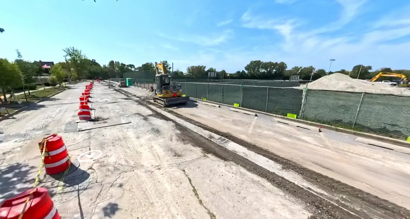
360-degree virtual walkthrough of a road construction corridor
PRJ-01 · Blue Island, IL

3D Virtual Walk

360° construction walkthrough

For a major road construction initiative in Blue Island, Illinois, city officials needed a way to monitor project progress remotely with the same clarity and detail as a Google Street View experience. We delivered a comprehensive 360-degree virtual walkthrough of the entire project corridor, allowing stakeholders to virtually walk up and down the street and inspect every detail — no matter how far they were from the site. This immersive solution enabled city planners and engineers to track changes, document progress, and make informed decisions in real time, all from the comfort of their offices. Our advanced drone imaging and interactive mapping brought the job site to their fingertips, streamlining communication and project oversight.

  • /Full-corridor 360° coverage
  • /Remote progress documentation
  • /Street-view style navigation
  • /Faster stakeholder decisions
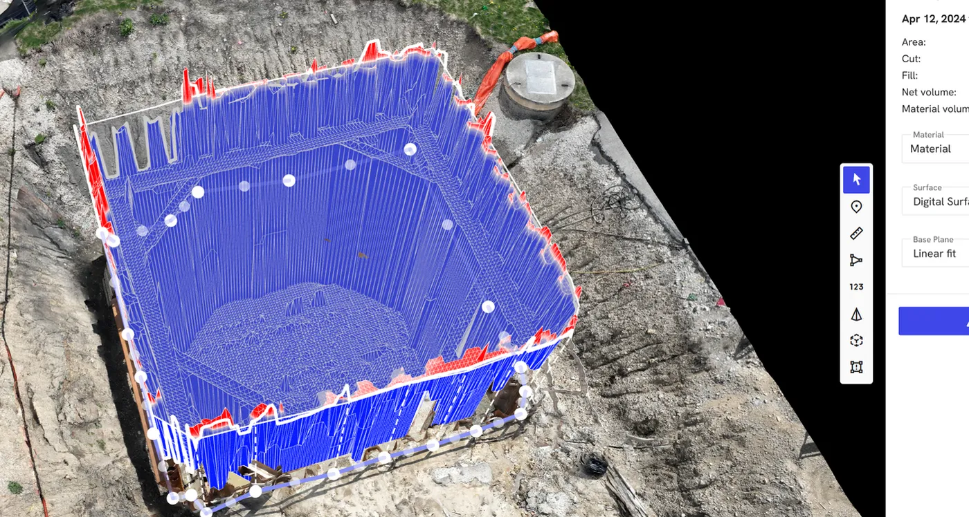
Colorized cut and fill volume map of a pump station excavation
PRJ-02 · Lockport, IL

Cut/Fill Volume Analysis

Volumetrics & earthwork

When Airy Construction built a new pump station, they faced a significant challenge: a massive excavation left them uncertain about the true volume of earth removed. We stepped in with advanced drone mapping and cut/fill analysis, delivering precise data that revealed exactly how much material had been excavated. This allowed Airy's team to recalibrate the pump house dimensions with confidence, ensuring the project stayed on track and eliminating costly guesswork. Our high-resolution models and volumetric calculations provided the clarity needed for critical decision-making, streamlining the entire construction process.

  • /Verified excavation volumes
  • /Pump house dimensions recalibrated
  • /Guesswork removed from pay quantities
  • /High-resolution surface model
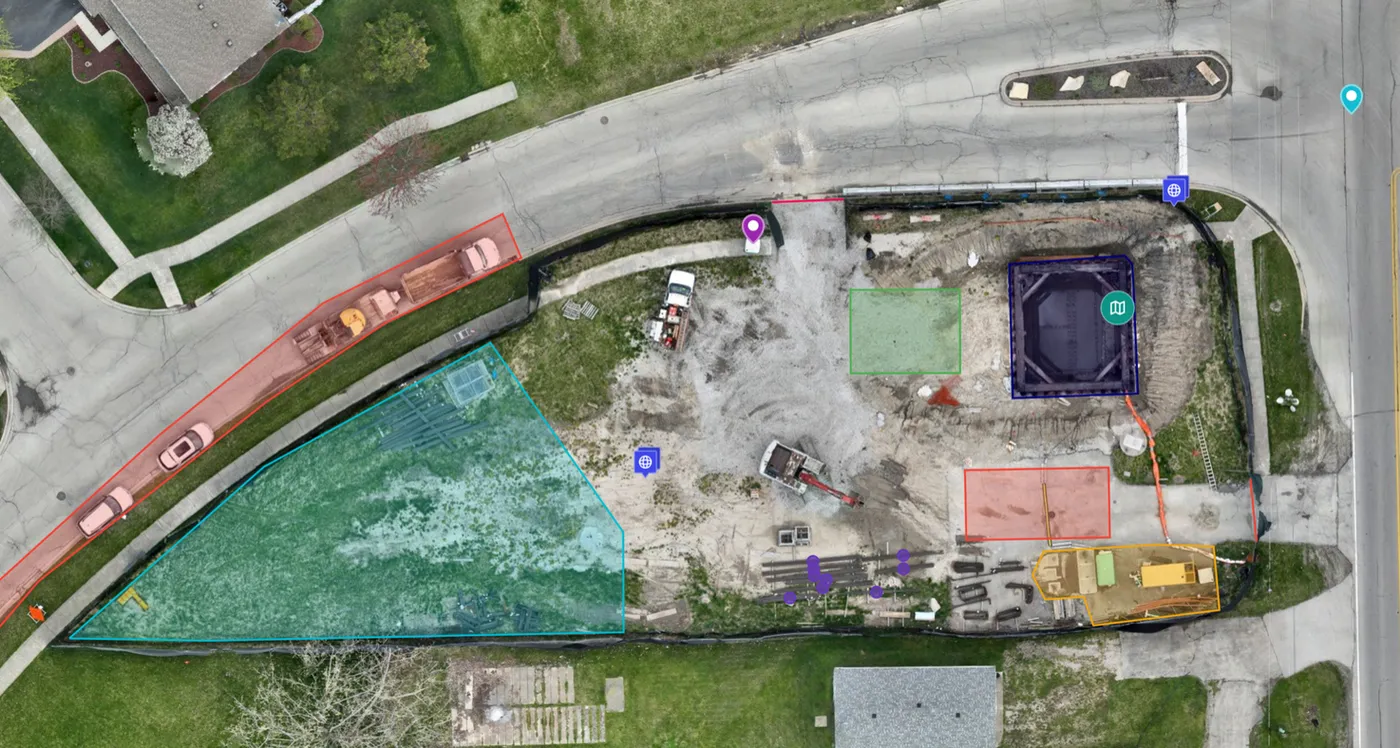
Overhead orthomosaic site plan with material storage and crane zones
PRJ-03 · Lockport, IL

Site Organization Plan

Site logistics mapping

During the construction of Airy's new pump station, our overhead drone mapping proved invaluable for site organization in a tightly confined space. By capturing a comprehensive aerial scan, we enabled the team to visualize and manage the entire job site with precision. Our high-resolution mapping allowed Airy to designate optimal material storage zones, accurately measure access points and entrances, and pre-plan a dedicated area for crane operations. We also provided spatial data to help lay out worker parking, ensuring every aspect of the site remained clear, efficient, and safe.

  • /Material storage zones defined
  • /Access points measured
  • /Crane pad pre-planned
  • /Worker parking laid out
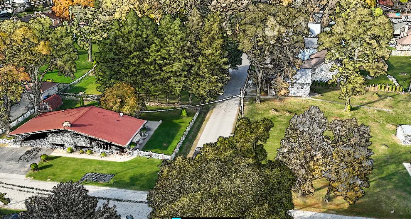
Colorized LiDAR point cloud of a roadway corridor
PRJ-04 · Justice, IL

Point Cloud LiDAR Data

LiDAR survey

Engineers working with the City of Justice, Illinois received detailed elevation and contour data for a spring project. This two-hour LiDAR scan saved tens of thousands of dollars in project costs and months of schedule time compared to conventional ground survey methods.

  • /2-hour flight and scan window
  • /Tens of thousands in cost savings
  • /Months of schedule recovered
  • /Contours and elevation delivered
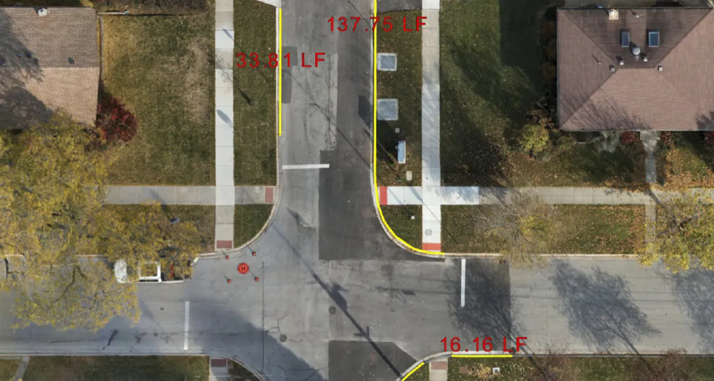
Measurement map marking new asphalt, curbs, sidewalks, and driveways
PRJ-05 · Mount Prospect, IL

Precise GNSS Measurements

Survey-grade quantities

Using the Emlid Reach RS3 GNSS receiver, we measured exact points for the start and end of all new poured asphalt, curbs, sidewalks, driveways, and sod so the prime contractor could produce actual measurements of the work completed — and be paid accordingly.

  • /Asphalt, curb, and walk quantities
  • /Driveway and sod limits captured
  • /RTK/PPK positioning
  • /Pay-quantity documentation
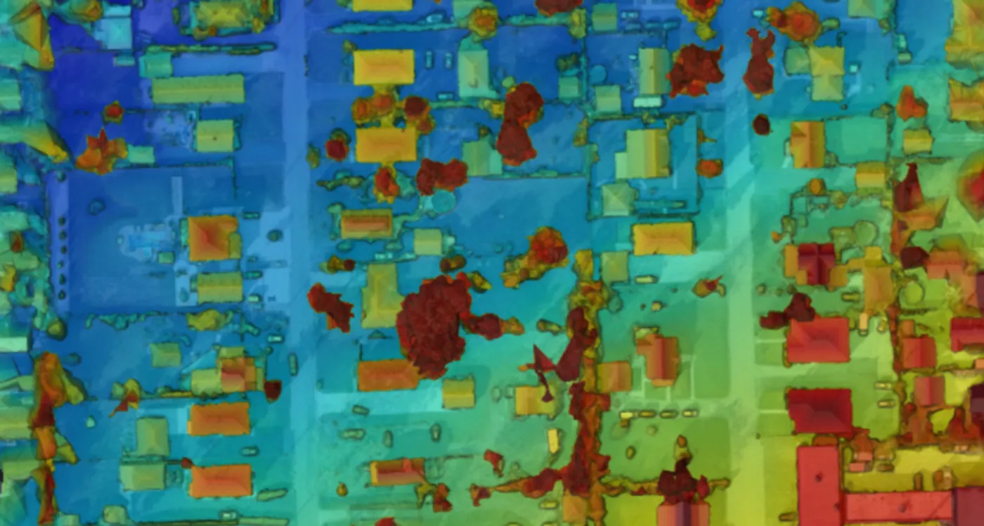
Elevation-colorized terrain model highlighting low-lying areas
PRJ-06 · Justice, IL

Elevation Data for Flood Planning

Terrain & drainage analysis

The City of Justice used our elevation data to assist with project planning in an area prone to water retention and flooding. This data was crucial in deciding how to execute the project and alleviate these problems before construction began.

  • /Retention areas identified
  • /Drainage-driven design input
  • /Colorized elevation model
  • /Pre-construction risk reduction

Have a site that needs this treatment?

Send us the limits and the deliverable — we'll scope the flight and the data package.